Surge Narrows on Quadra Island is a fantastic hike with a very unique destination. Watch the ocean turn into flowing rapids right in front of your eyes!
We heard Surge Narrows was cool and off the beaten path, but I had no idea how true both those statements were.
To visit Surge Narrows on Quadra Island, you definitely have to want to see it.
The drive out is an adventure in itself and if you plan your day just right, you can stop at one of the lakes along the way for a freshwater swim during a hot part of the day before or after your hike.
Surge Narrows gets its name because there are a couple of very small islands just off Quadra that create a small channel for the ocean water to pass. As the tide goes in and out throughout the day, the water surges through this channel creating river-like rapids.
It’s quite a site to see as usually the water surrounding Quadra Island looks peaceful and serene.
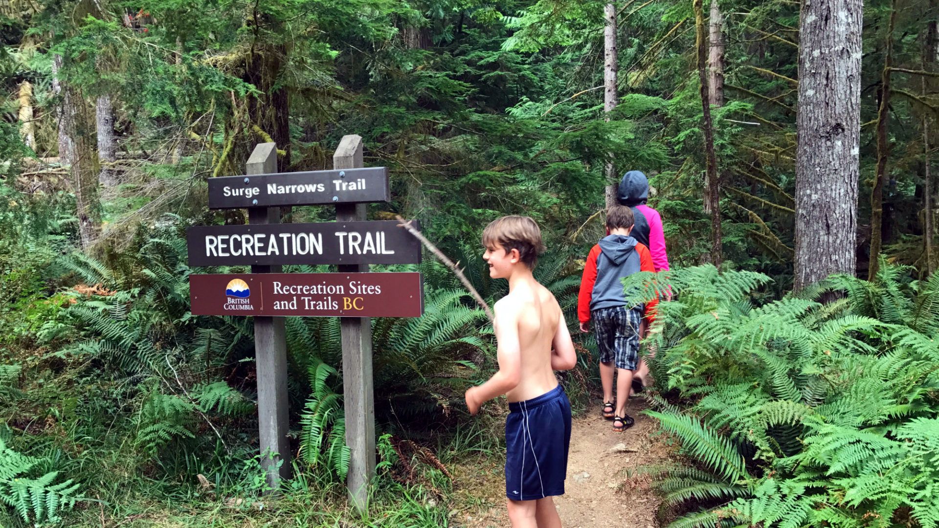
The fairly easy hike takes roughly 40 minutes depending on your ability and will take you directly to Surge Narrow Rapids.
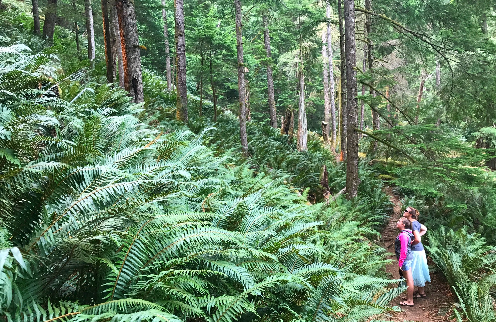
Be sure to come here for the hike too as it’s well worth it! You’ll be hiking beneath a canopy of giant trees with glimpses of the ocean off to your side. Our favourites were the prehistoric size ferns as many were well over our kids heads spread throughout the forest walk.
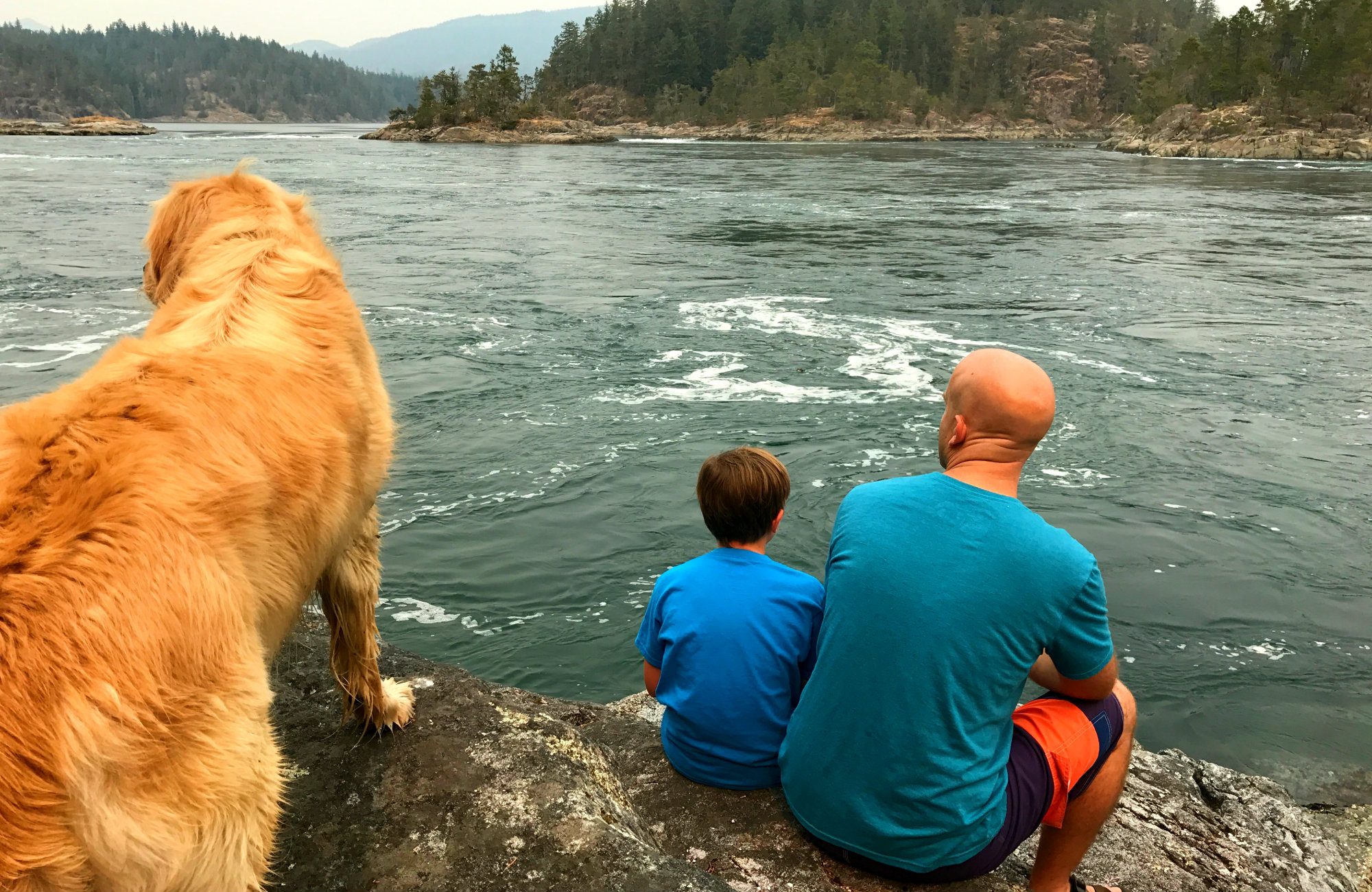
The rapids change depending on the tide, so every time you visit it could look a bit differently. Take time to sit and watch the rapids morph right before your eyes.
Bring plenty of drinking water and snacks for the journey as there are no stores to help you out should you find yourself hungry and thirsty. And I’m not just talking about at Surge Narrows, this drive really does take you off the beaten path.
If you time your visit just right you might get to see a kayaker having fun surfing the Surge Narrow waves!
Directions to Surge Narrows on Quadra Island
From Heriot Bay go north on Hyacinthe Bay Rd. and don’t leave this road until the end (about 40 minutes). It changes names twice, once to Bold Point Rd and then again to Surge Narrows Rd. You’ll be on a well-maintained gravel road for a good portion of it.
You’ll know you have arrived because the road ends and then becomes VERY steep. Park in the parking lot before the steep 4×4 only part.
Walk down to the trailhead on your left and look for the official looking marked BC recreation hiking trail.
The below Google Map takes you to the parking lot for the trailhead to Surge Narrows.
Comments